 Translate
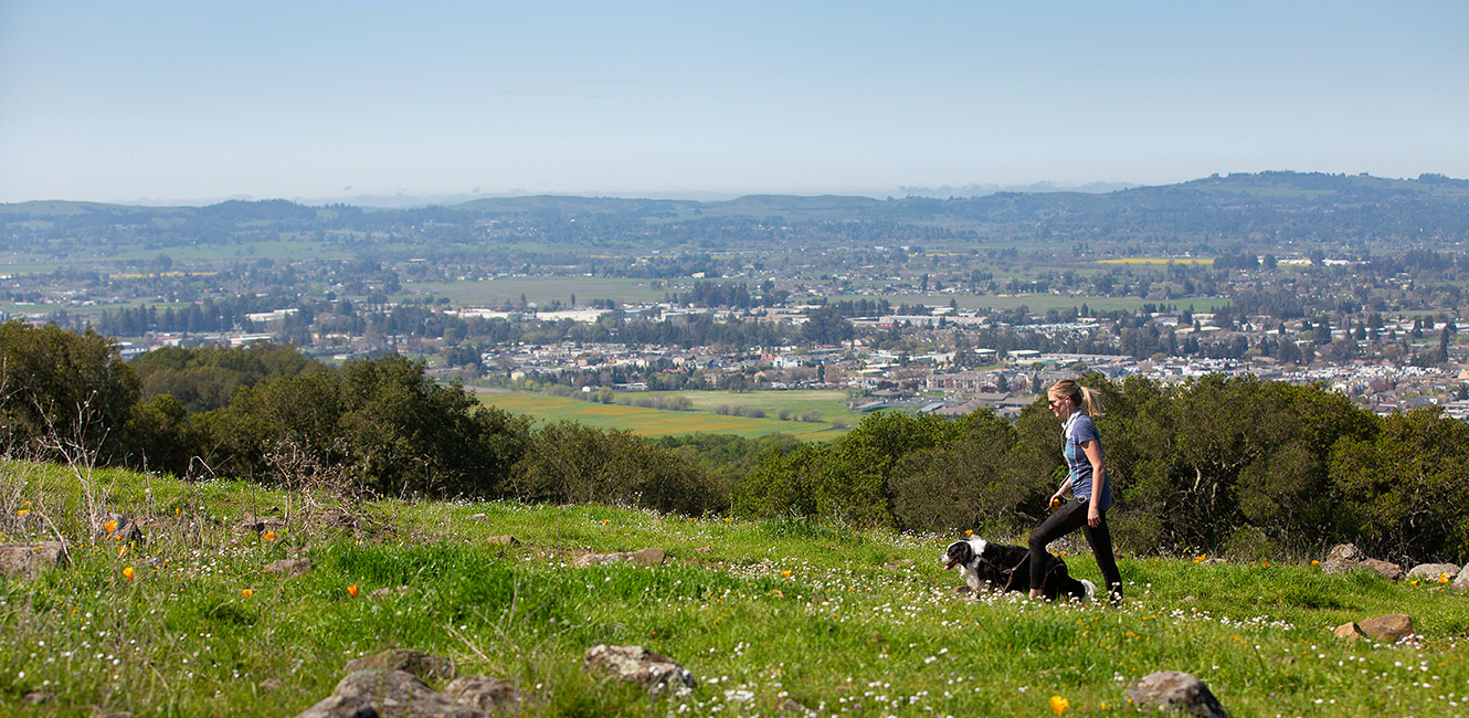
Taylor Mountain Regional Park and Open Space Preserve
2080 Kawana Terrace, Santa Rosa, CA 95404
Google Maps™ Directions
Local Weather


Dogs
Allowed on leash
Restrooms
Portable toilets and pit toilets
Park Information
Taylor Mountain Regional Park & Open Space Preserve is a prominent landmark in southeast Santa Rosa and offers panoramic views of the city from trails that climb to the summit.
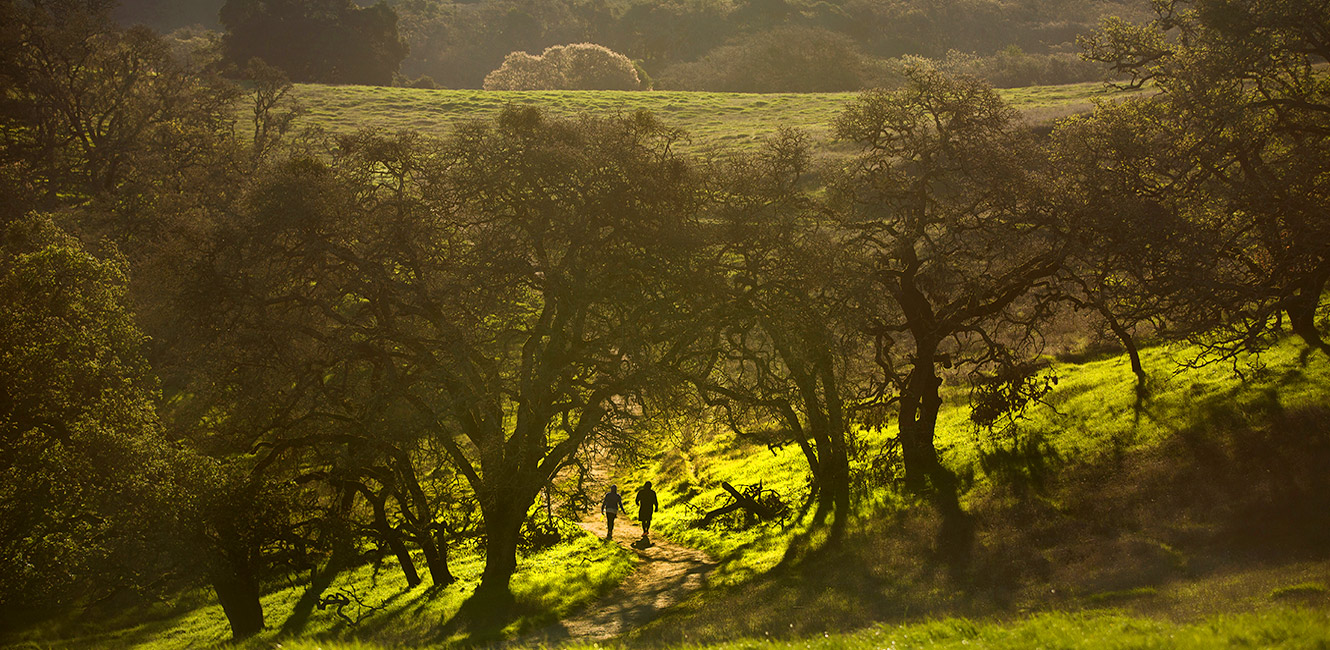
- This 1,100-acre park features grassy hillsides, oak woodlands and several creeks that all provide habitat for a variety of wildlife.
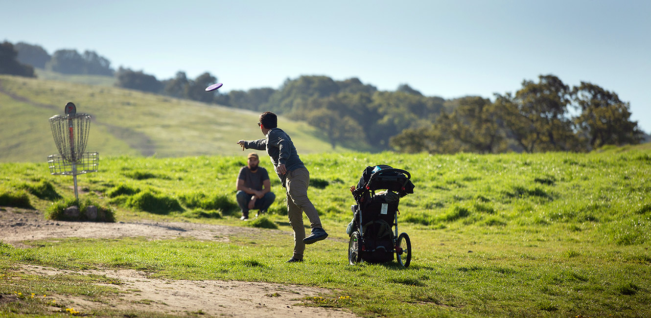
- The park features approximately 7 miles of trails for hiking, biking and horseback riding, an 18-hole disc golf course and an accessible natural play area.
- The park's master plan calls for the eventual development of 17 miles of trails, hike-in campsites, a visitor center and other features as funding becomes available.
Entrances
- North Entrance - Kawana Terrace: 2080 Kawana Terrace, Santa Rosa
- South Entrance - Petaluma Hill: 3820 Petaluma Hill Road, Santa Rosa
Trails
New trails coming to Taylor Mountain: Project boosts park access for hikers, equestrians, cyclists and emergency vehicles - no closures are anticipated during construction. Learn More.
Two routes - the Sky Lupine/Eastern and Western Routes - lead to the mountain's mid-section, with the Sky Lupine/Eastern Route continuing on to the summit for a 1,100-foot elevation gain. The Todd Creek and Red Tail trails offer less-strenuous hikes through oak woodlands.
- The Sky Lupine Trail offers the best route for those looking to make the 1,100-foot ascent from the Kawana Terrace entrance to near the top of Taylor Mountain, with sweeping views of Santa Rosa and beyond.
- The Western Trail also offers a challenging yet gradual climb up the mountain from the Kawana Terrace entrance and connects to several other trail loops on the southwestern side of the park.
- The relatively flat Todd Creek Trail loops off of lower Western Trail, passing through an oak woodland for 0.7-miles.
- The 1.2-mile Red Tail Trail begins at the park's Petaluma Hill Road entrance and weaves through oaks and grassy meadows with gradual climbs, looping back to the parking lot. At about the mid-point, a 0.2-mile trail connector links to Western Trail.
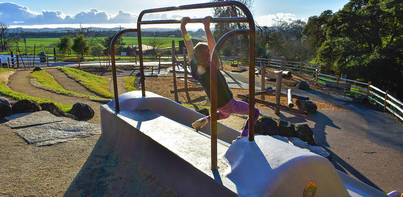
Red Tail Play Area
The Red Tail Play Area, a nature-inspired playground for families, is at the park's south entrance (Petaluma Hill Road). The accessible play area includes an embankment slide, natural stone and log climbing features, benches and picnic tables, a basket swing, and an interactive, supersized red-tailed hawk’s nest.
Cattle Grazing
Prior to becoming parkland, the property comprising Taylor Mountain Regional Park and Preserve was used for ranching, and cattle grazing continues in the park. Cows are not aggressive by nature, but if aggravated or threatened, they will defend themselves. Learn more about grazing in Sonoma County Regional Parks.
- Tips for sharing trails with cattle:
- Keep your dog on a leash: Dogs are perceived as predators. Cows cannot distinguish the difference between a coyote and a dog and may become aggravated by an off-leash dog.
- Do not attempt to pet or feed the cows: Do not get in between a calf and its mother and do not approach a stray calf, as its mother is likely nearby.
- If cattle are blocking the trail: Make yourself known well in advance by waving your arms and shouting. This will usually make cows scatter.
- Give cattle plenty of space and an avenue of escape: If you encounter a cow that acts in a threatening manner or appears to be sick, injured or dead, please take note the location and report it to parks staff.
Electric Vehicle Charging Station
A solar-powered Electric Vehicle Charging Station was installed in the park in September 2023, and is located at the Petaluma Hill Road entrance. Use of the charging station is included in the park entry fee. Read the press release.
Accessibility
The park features accessible parking, picnic site and a portable restroom.
Park Map
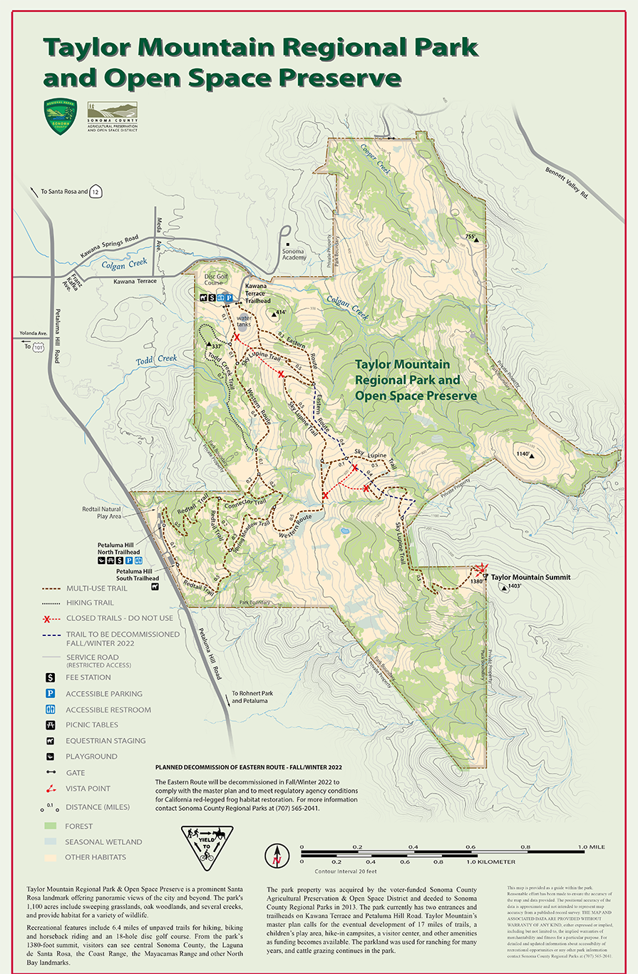
Taylor Mountain Regional Park & Open Space Preserve is a prominent Santa Rosa landmark offering panoramic views of the city and beyond. The park's 1,100 acres include sweeping grasslands, oak woodlands, and several creeks, and provide habitat for a variety of wildlife.
Recreational features include approximately 7 miles of unpaved trails for hiking, biking and horseback riding, a children's play area, and an 18-hole disc golf course. From the park's 1380-foot summit, visitors can see central Sonoma County, the Laguna de Santa Rosa, the Coast Range, the Mayacamas Range and other North Bay landmarks.
The park property was acquired by the voter-funded Sonoma County Agricultural Preservation & Open Space District and deeded to Sonoma County Regional Parks in 2013. The park currently has two entrances and trailheads on Kawana Terrace and Petaluma Hill Road. Taylor Mountain's master plan calls for the eventual development of 17 miles of trails, hike-in campsites, a visitor center, and other amenities as funding becomes available. The parkland was used for ranching for many years, and cattle grazing continues in the park.
Trail Lengths
- Western Route: 1.4 miles
- Todd Creek Trail: 0.7 miles
- Redtail Trail Loop: 1.2 miles
- Sky Lupine Trail: 1.4 miles
- Connector Trail: 0.2 miles
Upcoming events at Taylor Mountain
No Upcoming Events...