Get off the beaten path – and onto a new trail – at Hood Mountain Regional Park
By Sarah Phelps
Lauded for its rugged beauty, Hood Mountain Regional Park and Open Space Preserve is a wildland gem, tucked away in the Mayacamas Mountains overlooking Sonoma Valley, only minutes from bustling downtown Santa Rosa.
While the park has long featured plenty of hiking options and scenic views, the construction of a 2-mile trail on the park’s western flank marks a special achievement.
Called the Lawson Trail, the route offers the public access to a 250-acre addition to the park, property that includes ridgeline vistas of the Napa hills on one side and, on the other, the Santa Rosa Plain, Sonoma Valley and – on a clear day – San Francisco Bay.
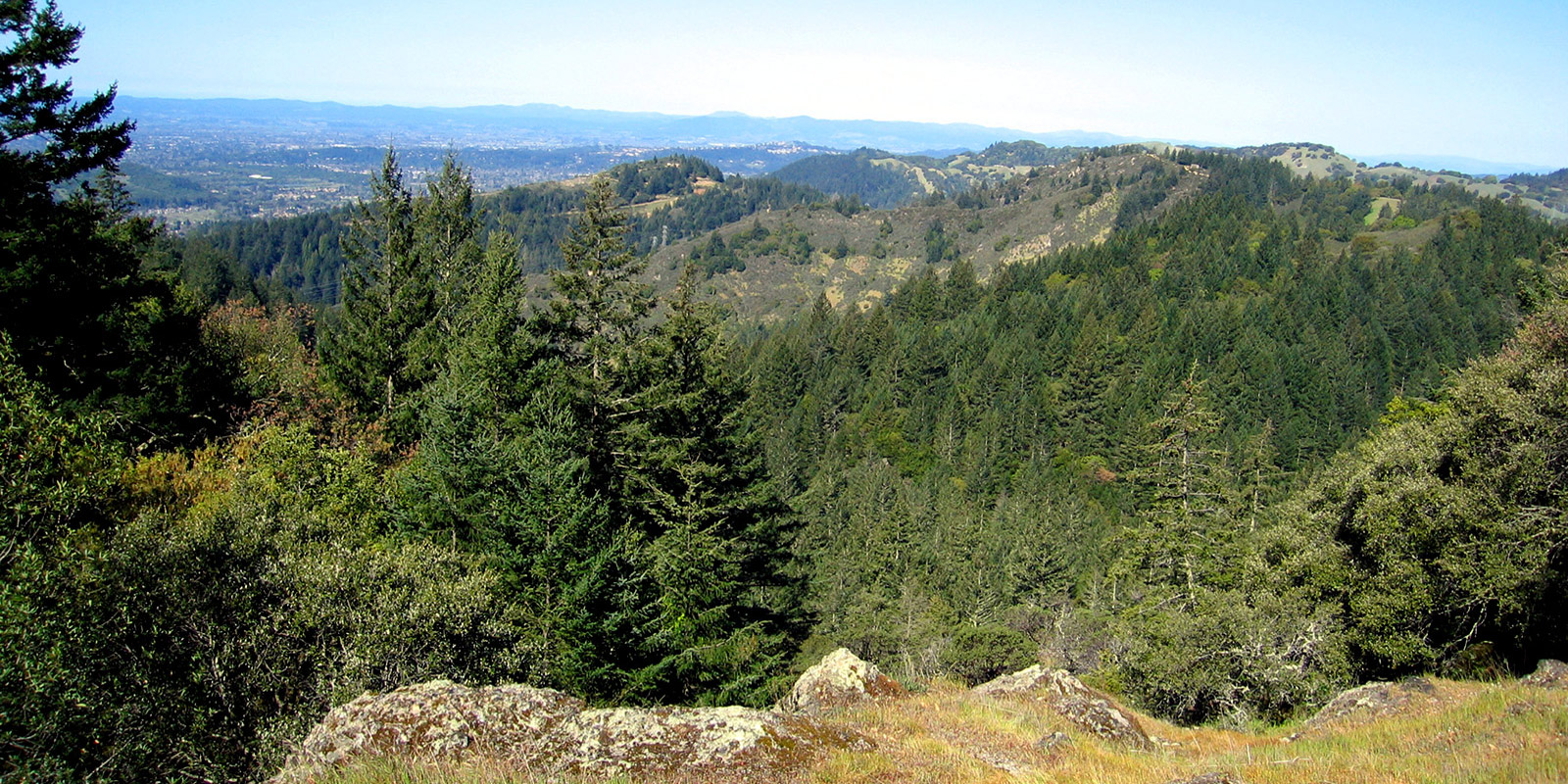
Nearly 2,000 feet above Sonoma Valley
This multi-use trail gradually climbs and zigzags from green creek canyons, up through oak, chaparral and cypress woodland and across a ridge with sweeping views. About one mile up, the trail enters the expanded park acreage. The area is known as the Lawson addition, a reference to the family who previously owned it.

While the switchbacks should get your heart rate up, the scenery will keep your mood lifted. The trail meanders through a mix of diverse geography and past several dramatic rock outcroppings, including a prominent boulder known informally as “The Spire.”

On a clear day, from the trail’s highest point of about 2,000 feet, views can stretch to San Pablo and San Francisco bays and all the way to the Pacific Ocean.

Pygmy forest and wildfire regrowth
Close to the top, the trail passes through a native pygmy Sargent's cypress forest (Hesperocyparis sargentii), transforming through the slow-but-steady process of regeneration after wildfire. Parts of Hood Mountain were badly burned during the 2017 Nuns Fire, and again during the Glass Fire in 2020.
Throughout the park you'll see regenerating trees, shrubs, grasses and forbs (flower-like plants). It can be fun to try to match what you remember of the plants and what they look like now.

Tiny Sargent cypress seedling
The area is home to several federally protected and rare plant species, including Napa false indigo (Amorpha californica) and Sonoma ceanothus (Ceanothus sonomensis).
History and significance
The Lawson addition lies at a junction of lands once stewarded by three indigenous tribes, the Wappo, Southern Pomo and Coast Miwok. During the late 19th and early 20th centuries, the property passed through homesteaders before the cattle-ranching Lawson family purchased it in the 1960s. The Sonoma County Agricultural Preservation and Open Space District bought the property for $1.16 million in 2005 and transferred it to Regional Parks in 2014. At the trail’s terminus, a picnic table sits in the shade of walnut trees planted decades ago.
Access for people and animals
Construction of the Lawson Trail is the first step in a multi-phased plan to develop a 4-mile multi-use trail network on the addition over the next several years.
Along with opportunities for human recreation, the property acquisition helps ensure the animal residents of the area – from squirrels to skunks to foxes to apex predators like bobcats, mountain lions and bears – can move freely between Napa and Sonoma counties through the Mayacamas, a significant wildlife corridor. Hood Mountain shares a border with 4,000-acre Sugarloaf Ridge State Park. Between the two, nearly 10,000 conjoined acres have been protected, creating a wildlife “bridge” between the counties.

Know before you go
You can reach the Lawson Trail from Hood Mountain's Pythian Road entrance, off of Highway 12. Park in the upper parking lot at the end of the road ($7 or free for Regional Park members). From the lot, it’s a one-mile trek up the steep Lower Johnson Ridge Trail until you reach a fork in the trail. Keep left and the Lawson Trail begins its ascent through madrone and oak woodlands. About halfway up, the tree canopy opens and views of Sonoma Valley spill out.
The lower part of the trail is under tree cover, but the top is rugged and exposed. Bring sunscreen and/or a hat and plenty of water. (Water is not available at the park.) Dogs on leash are OK.
The Lawson Trail is an approximately 4-mile total out-and-back adventure for hikers, mountain bikers and equestrians, but users will log about 6 miles total when adding in the distance from the parking lot to the trail. Download a trail map.
Don’t forget to take a picture at the top and tag @SonomaCountyParks on Facebook or Instagram to share your adventure.
Sarah Phelps is a marketing specialist at Sonoma County Regional Parks.
Published September 2020; updated March 2023
 Translate