Foothill Regional Park's Alta Vista Trail gives visitors a leg up
By Don Frances
Alta Vista Trail in Windsor’s Foothill Regional Park has always been popular for its eye-popping views. But it used to be a harder climb, heading straight up the hillside with some steep and slippery spots along the way.
That changed after Regional Parks in 2021 added switchbacks of banked, hard-packed earth that make the ascent and descent much safer and easier. The improvements enhance the natural beauty of this trail by letting hikers focus less on the path and more on their surroundings.

Great Views, Great Nature
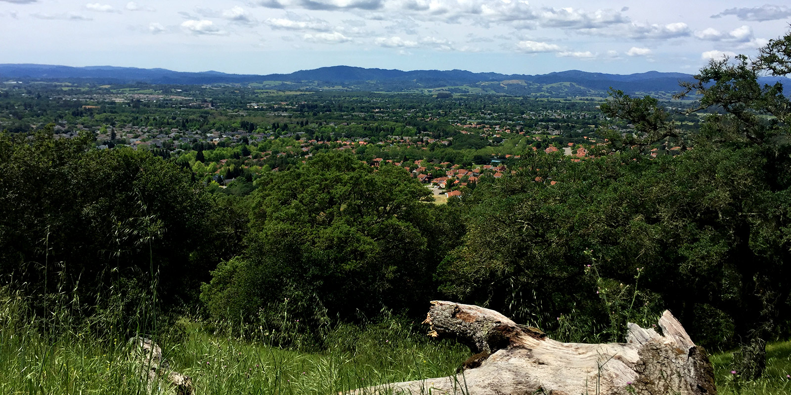
Alta Vista means “high view,” which at its peak is what this trail offers: an expansive 180-degree view to the southwest, overlooking the Santa Rosa Plain and Coastal Range beyond.
To reach that point from the Arata Lane parking lot, strike out eastward on Three Lakes Trail and stick to the right, keeping the lakes on your left and the park’s southern boundary on your right. Over bridges, under trees and just past Pond C, take the fork to the right onto Alta Vista Trail, which dives into stands of oak trees as you climb towards the park summit. (Download a pdf version of the park map here.)
A shaded bench at the summit—perfect for a picnic or just taking in the views—is followed by sharp turns to the left, taking hikers back down the hill. (While passing through this thickly wooded part of Alta Vista Trail, notice the dozens of blue, black and valley oaks that were charred by the Kincade Fire of 2019 but are nonetheless resprouting in their canopies. The area demonstrates how quickly oak woodlands can recover from wildfire.)

By the quickest return route—turning left at Oakwood Trail, taking it to Meadow Trail, and continuing back on to Three Lakes Trail to the parking lot—this hike’s total distance is just under 3 miles, with an elevation gain of about 600 feet. The hike can be easily expanded by continuing on any of several other trails, adding wider loops through wildflower meadows, alongside reedy ponds, and up more wooded hillsides.
About Foothill
Foothill Regional Park is a 211-acre wilderness park in the foothills of the Mayacamas Mountains. The park features thick oak woodlands, rolling hillsides, ridgetop views, three large ponds for bass and bluegill fishing, grassy meadows, and spring wildflowers. Its nearly 7 miles of trails cover varied terrain, offering easy to challenging options. The trails are open to hikers, mountain bikers and equestrians. Visit the Foothill webpage.
Know Before You Go
- Parking is $7 or free for Sonoma County Regional Parks members.
- Leashed dogs are welcome on trails.
- Park closes at sunset.
Don Frances is a former marketing specialist for Sonoma County Regional Parks.
 Translate