Skip to Content

Sonoma Schellville Trail
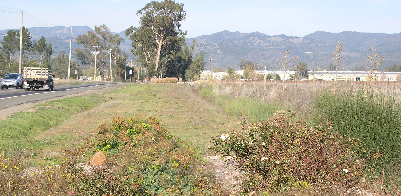
Trail View

What & Why?

The Sonoma County Regional Parks Department proposes to develop a 4-mile off-road bikeway (Sonoma-Schellville Trail) along the former Northwestern Pacific Railroad right of way.

The planned trail begins at Sebastiani Winery, near the terminus of the Sonoma Bike Path, and ends at Highway 121 and 8th Street East in Schellville. The planned trail will provide connectivity to the Central Sonoma Valley Trail to the north and will ultimately serve as a link to the San Francisco Bay Trail to the south.

What's Next?

County staff is presently negotiating with Union Pacific Railroad to acquire the remaining interests in the Northwestern Pacific Railroad right of way. The County anticipates completing the land purchase and starting the trail design and engineering during summer 2026. Compliance with CEQA and NEPA and regulatory permits are scheduled to be completed by the end of 2027. After the completion of environmental studies and approval of the design and engineering plans, construction of the trail will begin after additional funding is secured.

Frequently Asked Questions:

What is the Sonoma–Schellville Trail Project?

This project will turn an abandoned railroad corridor into a safe, scenic walking and biking trail connecting the City of Sonoma to the Schellville area. It extends the popular Sonoma Bike Path and will create a continuous, car-free route for recreation and transportation.

Where will the trail go?

The trail is being proposed in three connected segments:

  • Segment 1: Extends the Sonoma Bike Path east past Sebastiani Winery and Lovall Valley Road, crossing 7th Street East.
  • Segment 2: Curves south through the Sonoma’s Best area and connects to East Napa Street across from 8th Street East.
  • Segment 3: Follows 8th Street East down to the Highway 12/121 intersection using the former Union Pacific railroad line.
Why is the County purchasing the old railroad corridor?

Union Pacific still owns portions of the former railroad right-of-way or has restrictions on allowing trails. To build a public trail, the County must secure ownership of the land or legal rights to use it. The purchase ensures long-term public access and allows the County to safely build and maintain the trail.

How is the acquisition funded?

Funding comes from a combination of partners, including:

  • Sonoma County Ag + Open Space
  • State Coastal Conservancy
  • Measure M (Parks for All)
  • Regional Parks Mitigation Fees
Why has this acquisition taken so long?

The rail line dates back to the mid 1800s, long before California was a state. The County Board of Supervisors directed County staff to develop the Sonoma Schellville Trail which was first identified in the 1989 Sonoma County General Plan. Over the decades, the project was slowed by:

  • unclear and complicated historical property records
  • the need for new and clarifying boundary surveys
  • changing staff capacity
  • technical issues related to title and railroad rights
  • the presence of 12 railcars and 4 locomotives stored on part of the line

Those railcars are now being prepared for removal, clearing the way for acquisition.

What is the property used for now?

Although no longer an active railroad, parts of the corridor are used informally by walkers, cyclists, and nearby businesses for parking. Some areas are overgrown or contain invasive vegetation.

What will happen to the eucalyptus trees along the corridor?

The Board of Supervisors has funded the removal of eucalyptus trees within the railroad right-of-way. This will:

  • Reduce fire risk
  • Eiminate falling-branch hazards
  • Open the space needed to build the trail
  • Make room for replanting with more appropriate species
Why isn’t the appraisal public yet?

State law allows the appraisal to remain confidential until all the property has been acquired, or all of the contractual agreements have been  fulfilled. This protects taxpayers by preventing speculation or price inflation. Once the acquisition or pending contract is complete, the appraisal becomes a public document.

Is the County paying for land it already owns?

No. The County conducted extensive title research and boundary surveys to ensure taxpayers are not paying for rights, land or road easements the County already holds. The County is only purchasing Union Pacific’s remaining documented property rights.

What progress has been made so far?

Over the past several years, the County has:

  • secured multiple trail easements along 8th Street East and near Sonoma’s Best
  • purchased a parking lot at 8th Street East and East Napa Street
  • completed historic title research
  • commenced environmental studies
  • negotiated the terms of a purchase agreement with Union Pacific
  • begun the process of removing railcars from the line

The County is also in active negotiations to complete the “curve” segment near Sonoma’s Best.

When will construction begin?

Construction intends to begin after the corridor acquisition is finalized, remaining railcars are removed, environmental work is completed, and approvals and permits are secured. More detailed timelines will be released as each step is completed.

How can I stay informed?

Sonoma County Regional Parks will continue providing updates through community meetings, email newsletters, and the project’s webpage. Community members can also contact Regional Parks staff with questions or to receive regular project updates.

Resources