Crane Creek Regional Park
5000 Pressley Road, Rohnert Park, CA 94951
Google Maps™ Directions
Local Weather


Temporary Partial Closure: Construction of the 1.8-mile-long Copeland Creek Trail connecting to Petaluma Hill Road has begun. Due to the presence of construction equipment, park visitors are not permitted in the construction area - please respect closure signage and fencing. Disc golf course basket numbers 13 and 14 are temporarily closed during construction. The rest of the park remains open.
Dogs
Allowed on leash
Restrooms
Pit toilets
Park Information
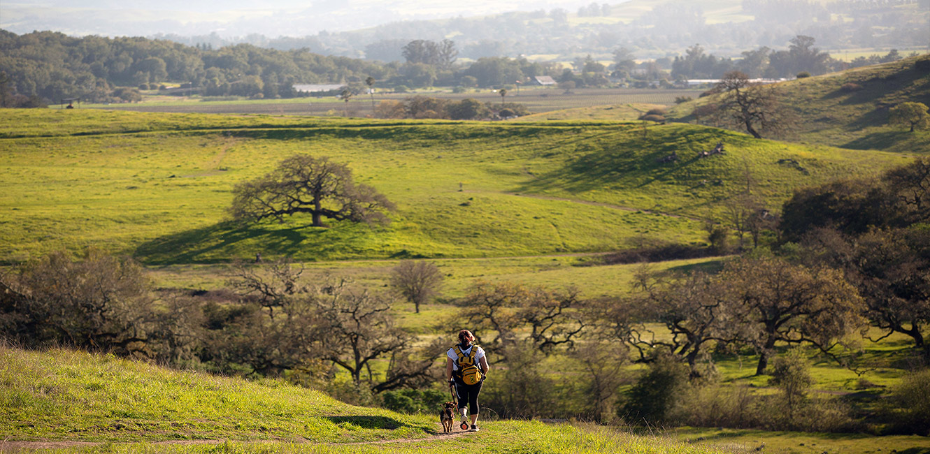
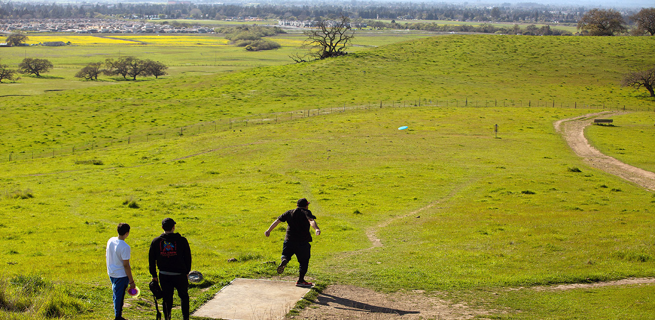
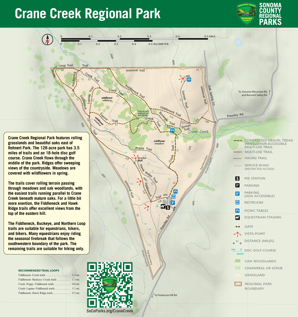
Crane Creek Regional Park features rolling grasslands and beautiful oaks east of Rohnert Park. The 128-acre park has 3.5 miles of trails and an 18-hole disc golf course. Crane Creek flows through the middle of the park. Ridges offer sweeping views of the countryside. Meadows are covered with wildflowers in spring.
Picnic tables are located throughout the park. Restrooms are in the parking lot. There is no drinking fountain.
Trails
Multi-use trails loop around the perimeter of the park, with additional hiking-only trails crossing the interior and running along the creek.
Crane Creek offers 3.5 miles of trail through meadows and oak woodlands. The trails cover rolling terrain, with the easiest trails running parallel to Crane Creek beneath mature oaks. For a little bit more exertion, the Fiddleneck and Hawk Ridge trails offer excellent views from the top of the eastern hill.
The Fiddleneck, Buckeye, and Northern Loop trails are suitable for equestrians, hikers, and bikers. Many equestrians enjoy riding the seasonal firebreak that follows the southwestern boundary of the park. The remaining trails are suitable for hiking only.
Recommended Trail Loops
- Fiddleneck - Creek trails = 1.3 miles
- Fiddleneck - Buckeye - Creek Trails = 1.3 miles
- Creek - Poppy - Fiddleneck trails = .8 miles
- Fiddleneck - Hawkridge Trails = .5 miles
- Creek - Lupine - Fiddleneck Trails = 1.1 miles
- Creek - Buckeye - Fiddleneck - Creek = 1.9 miles
Cattle Grazing
Cattle graze seasonally at Crane Creek to reduce fire risk and promote biodiversity. View tips for hiking and biking in parks where cattle graze.
Accessibility
The Creek Trail is wheelchair accessible with a compacted gravel surface with gentle grades.
 Translate