Monte Rio Redwoods Regional Park and Open Space Preserve
9610 Main Street, Monte Rio, CA 95462
Google Maps™ Directions
Local Weather


Open for Interim Public Access: Monte Rio Redwoods Regional Park and Open Space Preserve is open for interim public access while a master plan is developed. Please note we are still in the process of installing signage in the expansion area, and visitors may come across unmarked trails. Please use GPS and online maps until signage is completed.
Fuel reduction vegetation management crews working in October and November: Please note work crews will be thinning vegetation and building burn piles within the park through October and November. All trails will remain open, though visitors may see and hear chainsaws, pole saws and other heavy machinery being used. The burn piles will be left to cure and dry out to be burned in the winter after sufficient rain has fallen. Learn more about how we use prescribed fire to manage vegetation in our parks.
Hours
7:30 a.m. to half-hour before sunset
Parking
$8 or free for members. No equestrian parking is available.
Dogs
Allowed on leash on most trails. Prohibited on bike-only trails.
Restrooms
Portable toilets
Park Information
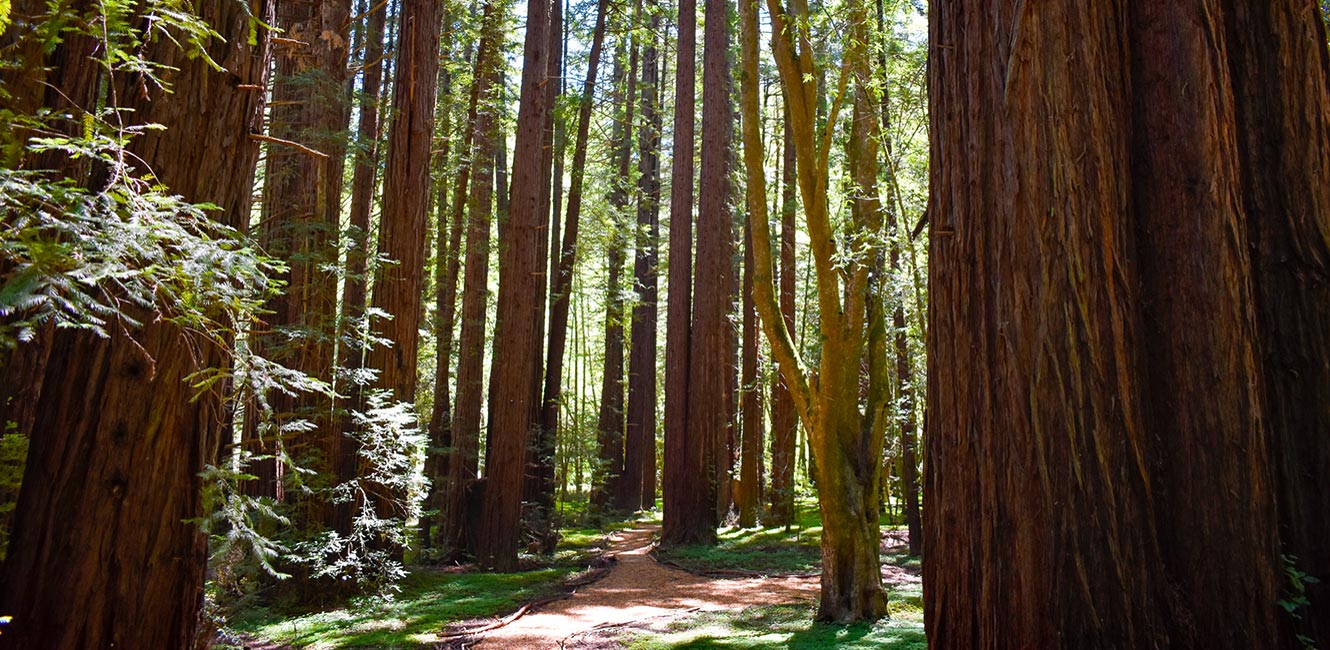
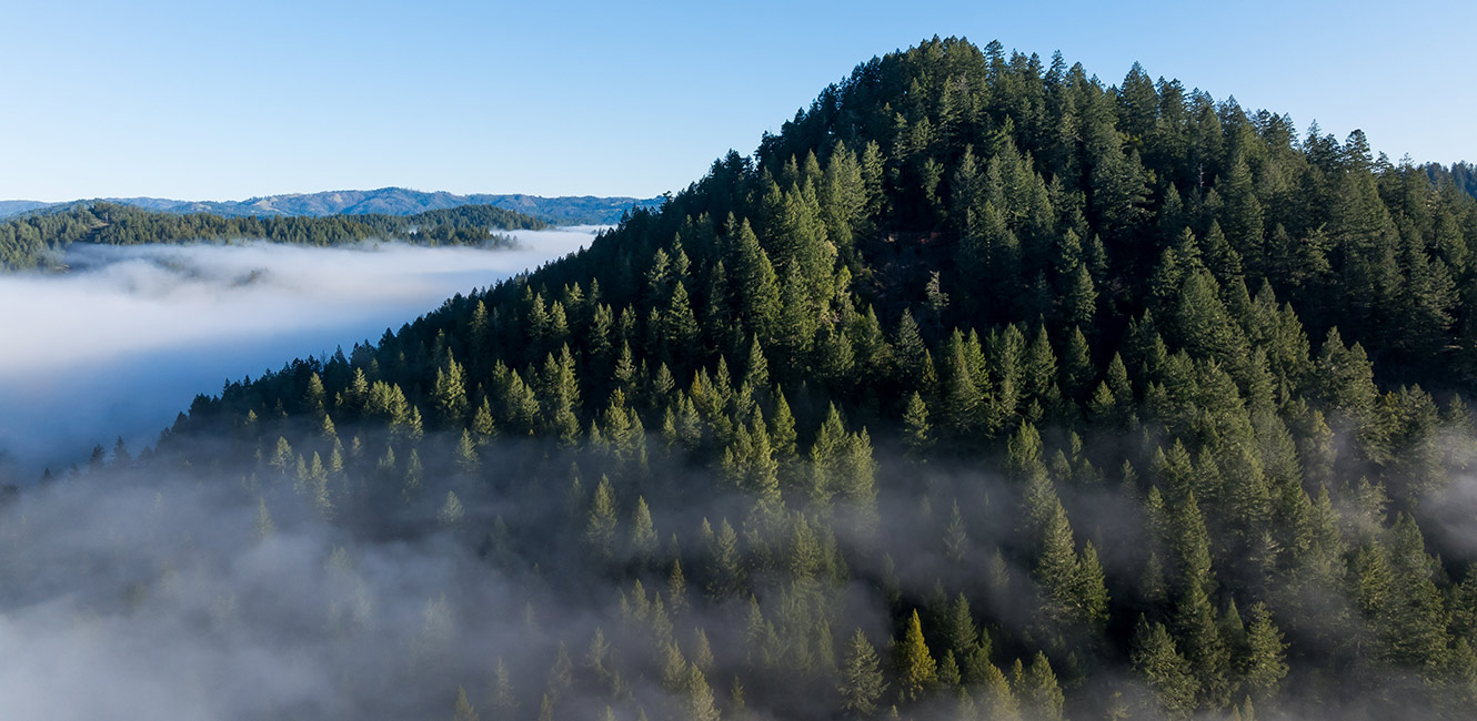
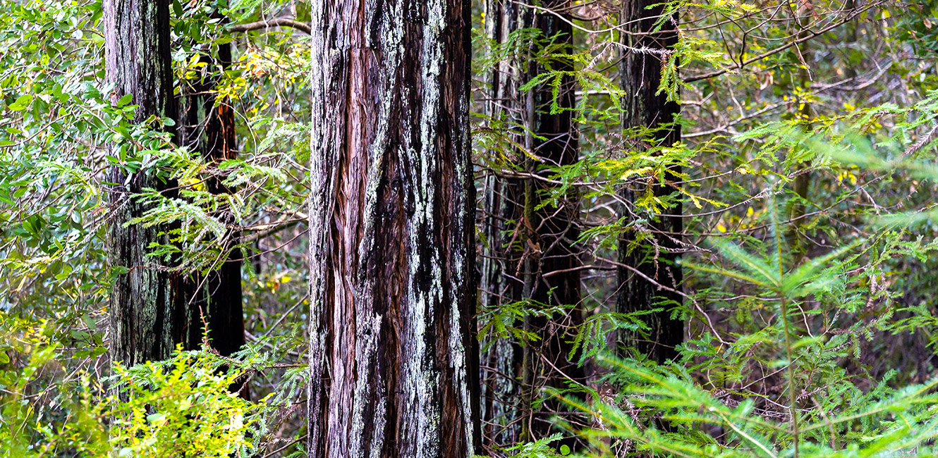
Monte Rio Redwoods Regional Park and Open Space Preserve is a 2,030 park near the West County communities of Monte Rio, Camp Meeker, Tyrone and Occidental. Open for interim public access while a master plan is being developed, the park offers miles of trails winding through redwood and Douglas fir forests and is a destination for hiking, mountain biking and picnicking.
The park currently has a portable restroom at the Main Street trailhead, and no drinking fountain.
Monte Rio Redwoods Expansion
Sonoma County Regional Parks established Monte Rio Redwoods Regional Park and Open Space Preserve in October 2020 with the purchase of the 515-acre Dutch Bill Creek property. Following this, Save the Redwoods League and its partners funded the purchase of an additional 1,517 acres of redwood forest and creek corridors, which the League then donated to Regional Parks. In June 2025, Regional Parks officially added this land, known as the Monte Rio Redwoods Expansion, to the preserve. The new property contains a network of former logging roads and trails with a history of use by mountain bikers and hikers. The park map has been updated showing these trails. For more information, read the press release.
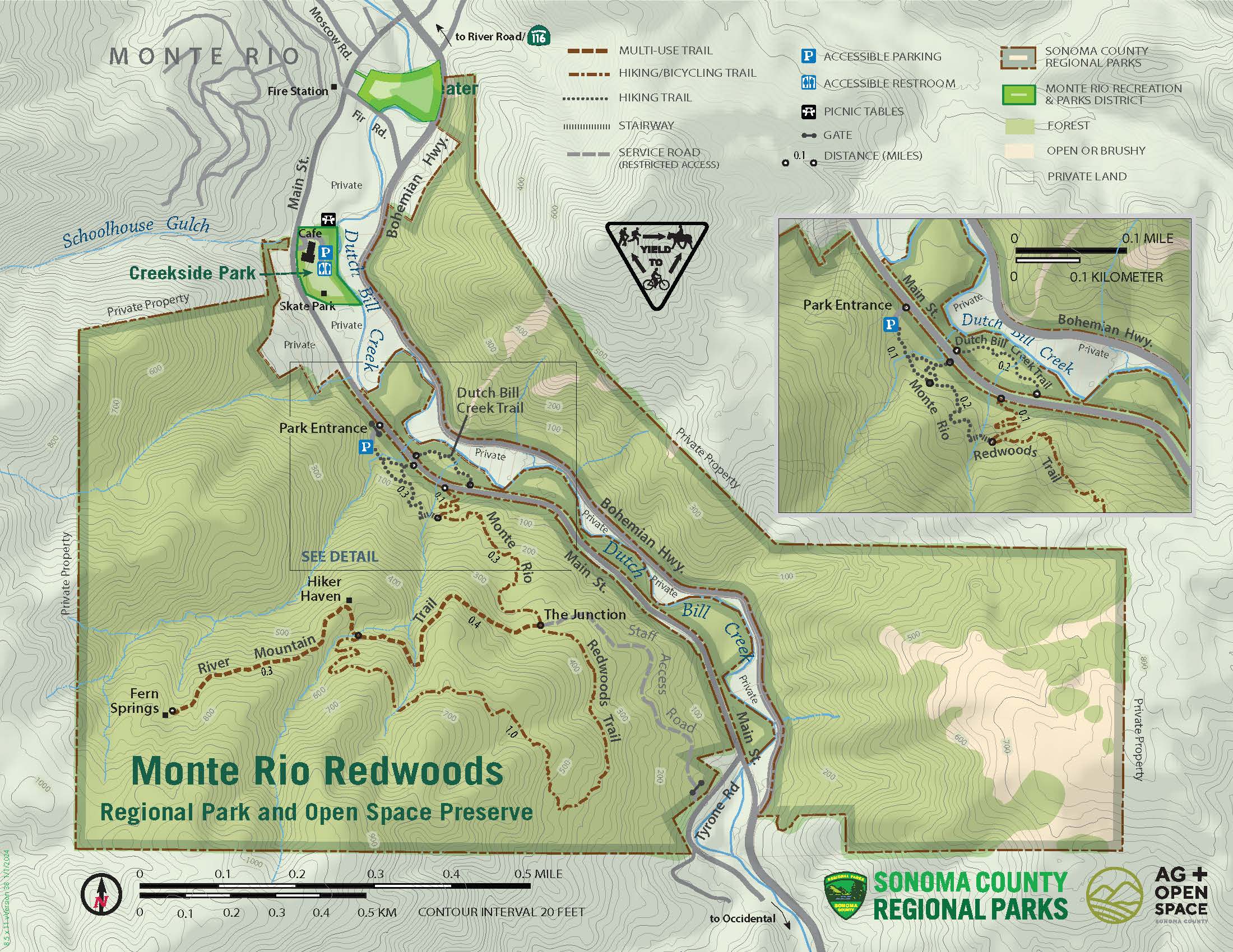
Trails
Monte Rio Redwoods features a growing network of trails that range from fire roads open to equestrian, cyclists and pedestrians to narrow single-track trails for cyclists and pedestrians. A few trails are pedestrian-only or cyclist-only. Dogs are prohibited on bike-only trails; dogs on leash are allowed on all other trails. Check the park map for details. Note that dogs are not allowed on adjacent California State Park trails.
Trail designations are noted on the park map and will also appear on signs as trail improvements continue. Please follow posted guidance for your safety and the safety of others.Trail access is available from multiple locations:
Main Street trailhead (9610 Main St., Monte Rio): Main parking area for hikers and cyclists. No equestrian parking.
Freezeout Road trailhead (25572 Freezeout Road, Monte Rio): Connects to Sonoma Coast State Park trails. Parking is allowed along the road.
Willow Creek Road trailhead: Hike-in and bike-in only; no vehicle parking. Cyclists are encouraged to ride in from Occidental.
From the Main Street trailhead:
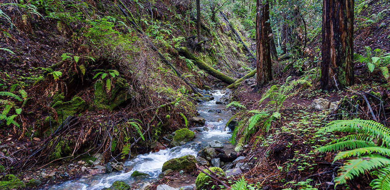
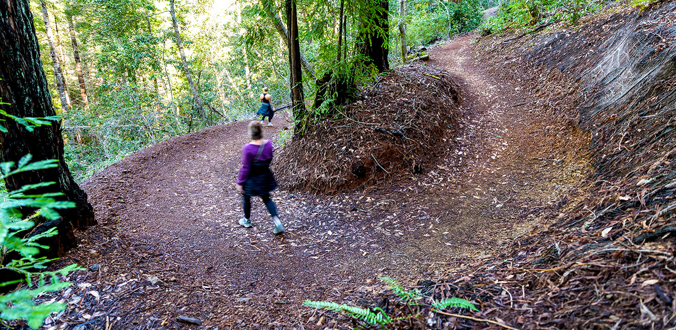
The .2-mile Dutch Bill Creek Trail, a pedestrian-only unpaved path with gentle grades, passes through a redwood grove along the creek. It's an inviting place to cool off on a hot day.
Another popular partial-loop route is to start at the parking area and combine the Monte Rio Redwoods Trail and the River Mountain Trail for a 2.4-mile route with about 835 feet of elevation gain. Hiker Haven is a pleasant knoll where you can stop to catch your breath.
Other trailheads:
Several miles of additional trails are now open as part of the recent Monte Rio Redwoods Expansion property acquisition. These trails are included on the map, with descriptions coming soon.
Accessibility
The park has no accessible features, though they are planned as part of the park's development.
 Translate